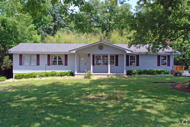
Property Record
7737 E Brainerd Rd, Chattanooga, TN 37421


NEARBY LISTINGS FOR SALE OR LEASE
Property Detail
7737 E Brainerd Rd
Chattanooga, TN-GA
Cedar Acres Second U
159I-A-012
LT 1 SECOND UNIT OF CEDAR ACRES PB23 PG83 REV 97-101 3273 01 008B
Restaurantdrivein
Hamilton
AE
Tennessee
47065C0369G
1
2024
0.74 AC
2024
Outlying Chattanooga
011321
Chattanooga
2,237 SF
DEMOGRAPHICS near 7737 E Brainerd Rd
1 Mile
3 Mile
5 Mile
2024 Total Population
7,302
48,084
103,643
2029 Population
7,780
50,972
109,702
Pop Growth 2024-2029
+ 6.55%
+ 6.01%
+ 5.85%
Average Age
40
41
41
2024 Total Households
3,173
20,033
41,678
HH Growth 2024-2029
+ 6.59%
+ 6.21%
+ 6.00%
Median Household Inc
$75,358
$76,985
$67,538
Avg Household Size
2.20
2.30
2.40
2024 Avg HH Vehicles
2.00
2.00
2.00
Median Home Value
$259,540
$254,724
$234,891
Median Year Built
1996
1991
1984
Nearby Places
Map Layers
Map Styles
 Street
 Aerial
- Restaurants
- Banks
- Shops
- Fitness
- Groceries
PUBLIC TRANSPORTATION
AIRPORT
Lovell Field
DRIVE
WALK
Distance
Lovell Field
12 min
4.6 mi
SALE & LEASE HISTORY
LISTING DATE
SALE/LEASE

Apr 13, 2018
For Sale
Nearby Properties
Address
Land Use
TOTAL SIZE
Lot Size
Zoning
Address
Land Use
TOTAL SIZE
Lot Size
Zoning
564,883 SF
27.46 AC
C2
Address
Land Use
TOTAL SIZE
Lot Size
Zoning
94,933 SF
23.87 AC
R4
Address
Land Use
TOTAL SIZE
Lot Size
Zoning
43,576 SF
6.66 AC
C2
Address
Land Use
TOTAL SIZE
Lot Size
Zoning
2,336 SF
21.34 AC
R3
Address
Land Use
TOTAL SIZE
Lot Size
Zoning
471,313 SF
18.01 AC
R3
Address
Land Use
TOTAL SIZE
Lot Size
Zoning
355,219 SF
27.72 AC
R3
Address
Land Use
TOTAL SIZE
Lot Size
Zoning
3,472 SF
14.01 AC
Address
Land Use
TOTAL SIZE
Lot Size
Zoning
254,362 SF
14.41 AC
R4
Address
Land Use
TOTAL SIZE
Lot Size
Zoning
254,432 SF
16.20 AC
R1
Address
Land Use
TOTAL SIZE
Lot Size
Zoning
97,000 SF
18.78 AC
Address
Land Use
TOTAL SIZE
Lot Size
Zoning
2,460 SF
15.30 AC
R3
Address
Land Use
TOTAL SIZE
Lot Size
Zoning
5,008 SF
17.97 AC
R1
Address
Land Use
TOTAL SIZE
Lot Size
Zoning
5,865 SF
21.90 AC
Address
Land Use
TOTAL SIZE
Lot Size
Zoning
1,960 SF
19.50 AC
R2
Address
Land Use
TOTAL SIZE
Lot Size
Zoning
245,744 SF
24.84 AC
Address
Land Use
TOTAL SIZE
Lot Size
Zoning
50,506 SF
5.14 AC
MD
Address
Land Use
TOTAL SIZE
Lot Size
Zoning
8,557 SF
14.30 AC
R2
Address
Land Use
TOTAL SIZE
Lot Size
Zoning
110,710 SF
6.69 AC
M1
Address
Land Use
TOTAL SIZE
Lot Size
Zoning
138,790 SF
36.30 AC
R3
Address
Land Use
TOTAL SIZE
Lot Size
Zoning
183,036 SF
11.49 AC
R4
Address
Land Use
TOTAL SIZE
Lot Size
Zoning
193,486 SF
14.18 AC
Address
Land Use
TOTAL SIZE
Lot Size
Zoning
1,200 SF
14.10 AC
Address
Land Use
TOTAL SIZE
Lot Size
Zoning
209,168 SF
23.28 AC
C2
Address
Land Use
TOTAL SIZE
Lot Size
Zoning
85,068 SF
9.57 AC
Address
Land Use
TOTAL SIZE
Lot Size
Zoning
121,263 SF
13.51 AC
C4
Address
Land Use
TOTAL SIZE
Lot Size
Zoning
67,735 SF
17.32 AC
M1
Address
Land Use
TOTAL SIZE
Lot Size
Zoning
66 AC
R4
Address
Land Use
TOTAL SIZE
Lot Size
Zoning
111,196 SF
9.67 AC
C2
Address
Land Use
TOTAL SIZE
Lot Size
Zoning
90,493 SF
1.88 AC
Address
Land Use
TOTAL SIZE
Lot Size
Zoning
147,332 SF
9.44 AC
R4
The World's #1 Commercial Real Estate Marketplace
Connect with us
© 2025 CoStar Group
The information above has been obtained from sources believed reliable. While we do not doubt its accuracy we have not verified it and make no guarantee, warranty or representation about it. It is your responsibility to independently confirm its accuracy and completeness. Any projections, opinions, assumptions, or estimates used are for example only and do not represent the current or future performance of the property. The value of this transaction to you depends on tax and other factors which should be evaluated by your tax, financial, and legal advisors. You and your advisors should conduct a careful, independent investigation of the property to determine to your satisfaction the suitability of the property for your needs.